Driving to New Mexico made us really appreciate our GPS, AND the maps and directions I printed out before we left. The drive takes you into Navaho Nation land, and the street/highway signs are much smaller and more subtle. Towards what we thought was the end of the drive, when it was pitch black dark outside, the highway turned to dirt road. We saw nothing but tumbleweeds, and one car of German tourists for the next hour. It was pretty scary, and I held tight to those maps as they were the only thing assuring me we were going the right way. Suddenly, the dirt road turned back into pavement and a sign appeared saying "Chaco Culture National Park". Whew.
We pulled into our campsite with next to no water, and no potable water at the campsite. There were bathrooms at least. On the positive side, the campground was gorgeous --right up against rock cliffs with petroglyphs in them. Of course it was too dark for pictures that night, and in the morning, everything electronic we had was dead dead dead. We packed up and headed into the park.
Chaco is set on a nine mile loop of road. We stopped at the entrance visitor's center for water, and the kids got a Junior Ranger packet to work on. Near the far point from the entrance was what I wanted to see most: Pueblo Bonito.
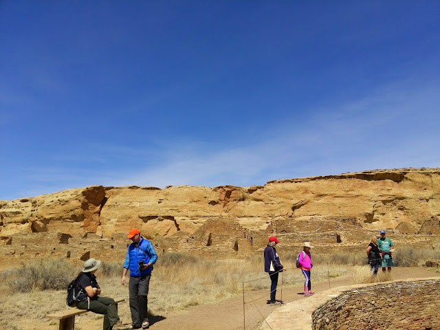
These aren't little village dwellings, Chaco was a major cultural site between 800 AD and 1200 AD. It was like the place everyone came to to see and be seen. There were trade roads to and from here that connected all the way to central America. The buildings here were sometimes four stories tall!
Pretty impressive.
There were multiple circular kivas, main courtyards, and outter strip mall kind of buildings around the edges. The main buildings in the center were tall, and so much was intact!
These doorways! Original beams in some of them. This makes that wood maybe 1000 years old. They look tall but...
No. It didn't mean the people were this short, but that they made the doorways small so they were easier to block up if needed.
They put together rough walls with sandstone and mortar, and then did a second layer of the lovely matched stones as a veneer layer. They then covered the whole thing with plaster to help keep the walls strong in rain and weather.
We walked the petroglyph trail between Pueblo Bonito and Chetro Ketl which was cool, then walked around Chetro.
I hope I didn't mix too many pictures up! I think these are all Chetro Ketl.
The last place we went to were the Casa Rinconada with its small villages. Every mound in this area was ruins, either covered, or uncovered. We were a little sad to learn that they weren't planning on excavating any more. They can now see things through the earth with new technology, and feel that the earth protects the ruins. In my opinion, they should be uncovered to share with everyone, but I can see that it is more expensive to maintain uncovered buildings.
The most impressive thing in this area was a huge kiva. It was 64 feet across (I looked it up), and apparently has a 12 foot underground tunnel that goes into it that they theorize was used for dramatic purposes.
You'll be happy to know that the kids both got sworn in as Junior Rangers. I was so proud! :)
I have to admit -- Chaco was my favorite among the four corners, but Arizona's Canyon de Chelly had its own advantages. After listening to a hippie lady talk to us about solstices and stuff for 40 minutes on the side of the road in Chaco (we kind of got stuck....), we were off to Arizona!


4 comments:
Beautiful place. We have to go here too.
It really does look interesting. The navigation part sounded a little scary though.
Oh my, it's beautiful. No wonder Sam's aunt loves it. I want to go!
So interesting! I really do love the desert!
Post a Comment